
| HOME PAGE |
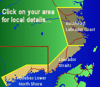
| Forecast Area Map & Information |
| · Southeast Labrador Coast |
| · Labrador Straits |
| · Quebec Lower North Shore |
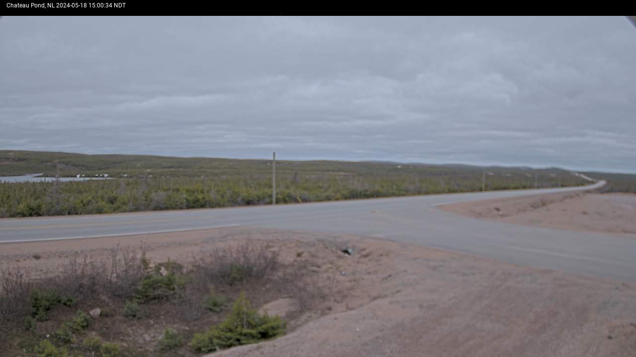
| Canadian Weather Webcams |
| Stormpost Photo Collection |
| Local Climate |
| Weather Links |
| About stormpost.com |
| Contact Rodney |
|
Disclaimer: Although I am dedicated to providing quality weather information on this web site, I cannot guarantee its accuracy or timeliness. My weather predictions are based on my own interpretations of the meteorological data to which I have access, and should not be confused with official forecasts provided by the Meteorological Service of Canada. The user hereby assumes all risks associated with the use of information on stormpost.com. Copyright (c) 2024 Rodney Barney |
- www.labradorcoastaldrive.com
- www.southernlabrador.ca
 |
|
|
Quebec Lower North Shore · St. Augustine River · St. Paul's River · Brador · Lourdes-de-Blanc-Sablon · Blanc-Sablon |
Labrador Straits · L'Anse au Clair · Forteau · Point Amour · L'Anse au Loup · Capstan Island · West St. Modeste · Pinware · Pinware River · Red Bay |
Southeast Labrador Coast · Lodge Bay · Mary's Harbour · Port Hope Simpson · Charlottetown |
Guest Photos
| Various photos by Robert Smith |
| Several photos from around the area, by Robert Smith of Photography Rob. |
| La Tabatiere, Quebec |
| Photos from the La Tabatiere area of Quebec, submitted by Karen Gallichon. |
| Ice and Snow Storm |
| Photos of a May freezing rain and snow storm, Victoria Day long weekend, 2007. |
| Trans Labrador Highway |
| Jamie Pye provided some photos of snowclearing operations on the Trans Labrador Highway, to the north of the Red Bay Depot. Taken on 02-April-2004. |
| Lourdes-de-Blanc-Sablon |
| Photos from after the February 2004 blizzard, submitted by Priscilla Dumas. |
| Southeastern Labrador |
| A variety of photos from north of Red Bay to Cartwright. Provided by Ewart Linstead. |
| Trans Labrador Highway. |
| Scenes along the Trans Labrador Highway between Red Bay and Lodge Bay. Provided by Lyle Smith. |
| Charlottetown after the 2004 blizzard. |
| Thanks to Lorenda Campbell for submitting these photos. |
| Crow Head area of Forteau Bay. |
| from Mike Belben. |
|
Crow Head and rock cut between Forteau and |
| Submitted by Natalie Normore after Feb 2004 blizzard. |
| Snowy scenes from Blanc-Sablon. |
| Submitted by David Bolger after the big blizzard. |
| Snow piled high in Mary's Harbour |
| Provided by Israel and Susie Penney. |
| St. Lewis Snowfall |
| Scenes from St. Lewis taken by Carl Bradley after the Feb 26-28, 2004 blizzard. |
| Capstan Island snowslide |
| Capstan Island snowslide photos. |
| Labrador Flag |
| Provided by Joe O'Dell, former Capstan Island resident now living in Torbay, Newfoundland. |
| Trans Labrador Highway - May 2001 |
|
Carl Bradley provided these scenes of the tremendous amount of snow along Trans Labrador Highway between Red Bay and Lodge Bay, taken
|
| Trans Labrador Highway - March 2001 |
|
Thanks to Jamie Pye for submitting these snowy images of the Trans Labrador Highway between Red Bay and Lodge Bay, taken
|
| Blizzards of 1995 |
| One of the snowiest months in recent memory along the Labrador Straits was March 1995. One storm early in the month lasted for more than two days and brought over 100 centimetres of snow. Subsequent storms that month brought the monthly total to over 200 centimetres. Ewart Linstead shares these photos of that stormy month. |

|
QUICK LINKS Wind Chill Calculator Meteorological Nfld & Labrador Winter Driving Conditions Labrador Marine Qajaq W Vessel Position Air Borealis PAL Airlines |
