|
Forecast Area Map & Information
|
Disclaimer: Although I am dedicated to providing quality weather information on this web site, I cannot guarantee its
accuracy or timeliness. My weather predictions are based on my own interpretations of the meteorological data to which I have
access, and should not be confused with official forecasts provided by the Meteorological Service of Canada. The user hereby
assumes all risks associated with the use of information on stormpost.com.
Copyright (c) 2025
Rodney Barney
|
To learn more about southeastern Labrador, check out:
- www.labradorcoastaldrive.com
- www.southernlabrador.ca
|
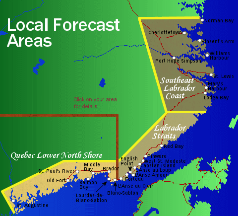
Stormpost Local Forecast Areas...
In order to provide detailed forecasts at a local level, I've divided the region up into three separate forecast areas.
1. Southeast Labrador Coast. This area includes all communities from Norman Bay in the north to Lodge Bay in the south,
and extends to approximately 60 kilometres inland. The Trans Labrador Highway extending southwestward from Lodge Bay to
roughly halfway to Red Bay is included in this area.
2. Labrador Straits. This takes in all communities from Red Bay to L'Anse au Clair, and also reaches about 30 kilometres
inland. It includes the Trans Labrador Highway from Red Bay northward to approximately halfway to Lodge Bay.
3. Quebec Lower North Shore. Communities from Blanc-Sablon in the east to St. Augustine in the west are included in this
area, which also extends to about 30 kilometres inland.
|
When I write my forecasts, I am generally thinking about what type of weather will impact the most people within a given area.
I realize that conditions sometimes vary considerably over short distances, and it is impossible to identify each local effect
with pinpoint accuracy. That's why you will sometimes see words such as "isolated", "scattered", or "patchy" mentioned.
When I am able to determine a significant variation, I will attempt to include it. A common example you will find in the
summer would be when I make mention of how temperatures will be cooler where winds blow onshore, or when fog may hug the
coast when there could be sunshine inland. Often during major winter events conditions will be much more severe in the hills than
in the more sheltered lower locations, so you will see this emphasized when necessary.
Here is a rough guide to some of the terminology I use and is by no means all-inclusive. Sometimes I make use of rather
vague wording while waiting for new information to arrive that will hopefully allow me to zero in with more detail. This
mostly happens when a weather system is still a large distance away and its course hasn't yet been fully determined.
- Isolated. Expected to occur over less than a quarter of the area.
- Scattered. Covering a quarter to half of the area.
- Patchy. Generally covering less than half of the area.
- Numerous. Affecting more than half of the area.
- Extensive or widespread. Covering more than three-quarters of the area.
- A few. Covering less than a third of the area, or occuring less than a third of the time.
- Occasional. Occurring about one to two-thirds of the time.
- Frequent. Occuring more than two-thirds of the time.
- Mainly. More than three-quarters coverage.
- Inland. In general, refers to locations sheltered from the ocean's effect. This depends on wind direction in some
areas. Most of the Trans Labrador Highway north of Red Bay should be considered as being inland, as well as the Pinware
River Valley. The towns of Charlottetown and Port Hope Simpson, although located near the water, often tend to have
weather that is more typical of inland locations. St. Augustine will often resemble inland sections more than coastal areas
of the Quebec Lower North Shore. Generally anywhere along the Labrador Straits or Quebec Lower North Shore that is more
than five kilometres to the northside of the main highway would typically feature inland weather.
- Coastal or near the coast. Typical refers to areas exposed to the open effects of the sea. Blanc-Sablon,
Point Amour, and Williams Harbour are prime examples. Some communities have neither purely coastal nor inland
weather, instead they are somewhere in-between, and the effect of the sea will vary depending on wind direction and strength.
Examples include St. Paul's River, Forteau, L'Anse au Loup, and Mary's Harbour. Often in these cases you just have to use your own
judgement!
- Higher terrain or in the hills. Generally refers to elevations over 250 metres or 800 feet above sea level.
Examples include the Brador Hills, the hills between the communities along the Labrador Straits, and much of the terrain
traversed by the Trans Labrador Highway between Red Bay and Lodge Bay.
|
|
|
FORTEAU BAY
Currently not updating
L'ANSE AU LOUP
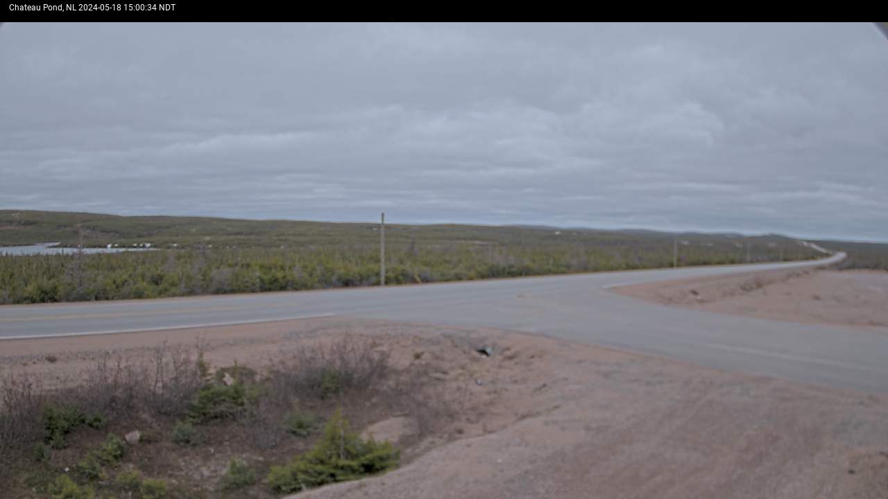
CHATEAU POND
MARY'S HARBOUR
CARTWRIGHT JCT
CROOK'S LAKE
PORT SAUNDERS
FLOWER'S COVE
ST. ANTHONY
-
|

|
