
| HOME PAGE |
| Forecast Area Map & Information |
| · Southeast Labrador Coast |
| · Labrador Straits |
| · Quebec Lower North Shore |
| Canadian Weather Webcams |
| Stormpost Photo Collection |
| Local Climate |
| Weather Links |
| About stormpost.com |
| Contact Rodney |
|
Disclaimer: Although I am dedicated to providing quality weather information on this web site, I cannot guarantee its accuracy or timeliness. My weather predictions are based on my own interpretations of the meteorological data to which I have access, and should not be confused with official forecasts provided by the Meteorological Service of Canada. The user hereby assumes all risks associated with the use of information on stormpost.com. Copyright (c) 2025 Rodney Barney |
- www.labradorcoastaldrive.com
- www.southernlabrador.ca
|
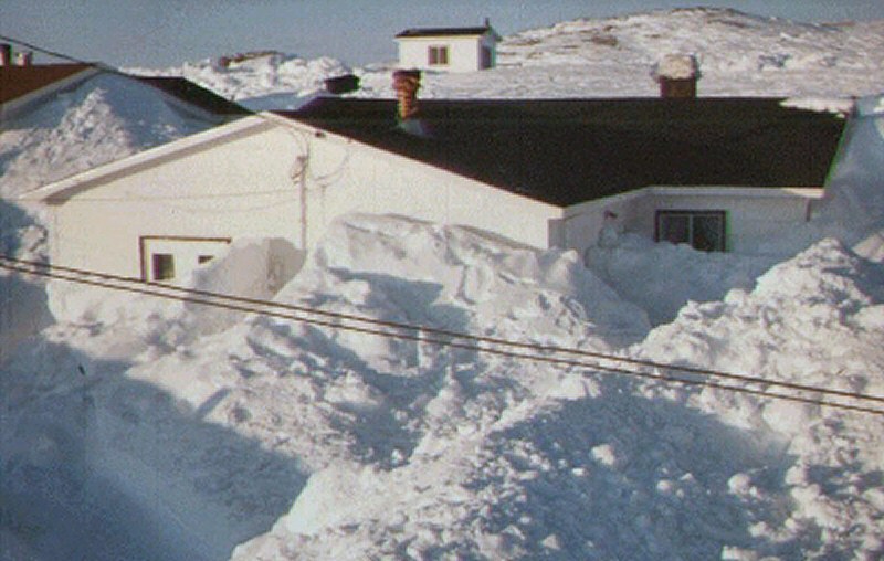
Ewart's Driveway MAR 1995 (Click to enlarge) This picture comes from Ewart Linstead's driveway in L'Anse au Loup after the storm. Scenes like this were common all over the Labrador Straits and Quebec Lower North Shore after the storm was over. |
|
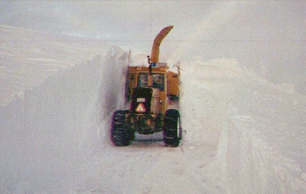
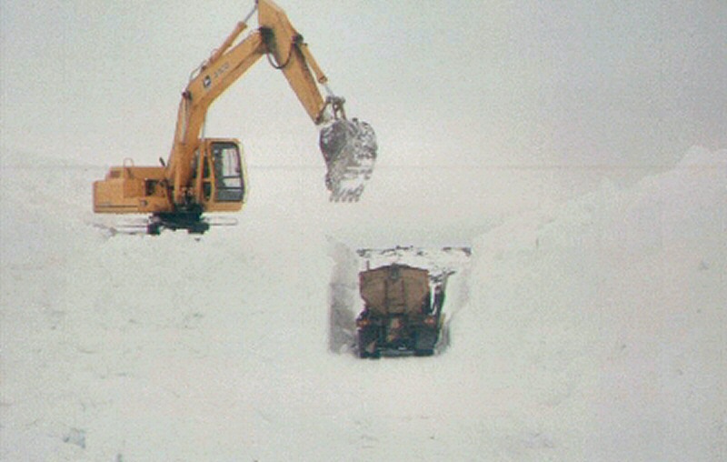
Clearing a Path MAR 1995 (Click to enlarge) It was weeks after the storm before all the roads in the area were cleared. This is a picture of Route 512, the main highway in the area. |
|
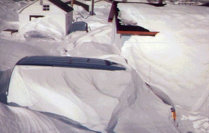
Buried in Red Bay MAR 1995 (Click to enlarge) This is what one house looked like after the mid-March storm. Notice how close the top of the snow bank is to the power line. One house in Red Bay had to be evacuated during the storm because it was completely buried and the roof was about to collapse. |
|
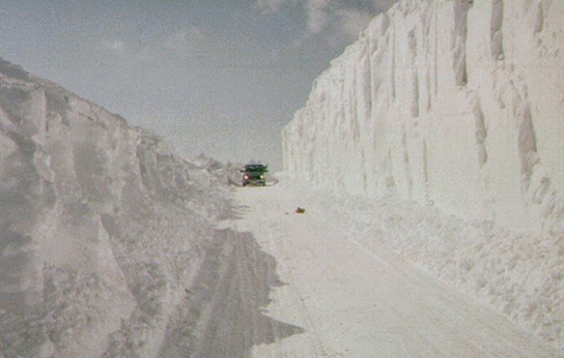
Open for Traffic MAR 1995 (Click to enlarge) This picture was taken after this stretch of highway finally got cleared. Remnants of the winter's snow lasted well into the summer. In some areas there was still snow along side the road in early-July, and on the hill spatches of snow lasted until September. |
|
More Snow MAR 1995 (Click to enlarge) If the first storm wasn't enough, two weeks later, around the end of March, another storm hit and the roads had to be all cleared out again. |
|
To see more of the Stormpost Photo Collection, just make a selection from the list on the right. |
|
QUEBEC LOWER NORTH SHORE
St. Augustine River
St. Paul's River
Brador
Lourdes-de-B.-Sablon
Blanc-Sablon
LABRADOR STRAITS
L'Anse au Clair
Forteau
Point Amour
L'Anse au Loup
West St. Modeste
Capstan Island
Pinware
Pinware River
Red Bay
SOUTHEAST LABRADOR COAST
Lodge Bay
Mary's Harbour
Port Hope Simpson
Charlottetown
GUEST PHOTOS
R. Smith (2007-08)
La Tabatiere (2008)
May Storm (May 2007)
TLH (Apr 2004)
Lourdes (Feb 2004)
SE Lab (Mar 2004)
TLH (Mar 2004)
Charlottetown
Crow Head
Crow Head & Rock Cut
Blanc-Sablon
Mary's Harbour snow
2004 Blizzard
Snowslide (Capstan I.)
Labrador Flag
TLH (May 2001)
TLH (Mar 2001)
1995 Blizzards