
| HOME PAGE |
| Forecast Area Map & Information |
| · Southeast Labrador Coast |
| · Labrador Straits |
| · Quebec Lower North Shore |
| Canadian Weather Webcams |
| Stormpost Photo Collection |
| Local Climate |
| Weather Links |
| About stormpost.com |
| Contact Rodney |
|
Disclaimer: Although I am dedicated to providing quality weather information on this web site, I cannot guarantee its accuracy or timeliness. My weather predictions are based on my own interpretations of the meteorological data to which I have access, and should not be confused with official forecasts provided by the Meteorological Service of Canada. The user hereby assumes all risks associated with the use of information on stormpost.com. Copyright (c) 2025 Rodney Barney |
- www.labradorcoastaldrive.com
- www.southernlabrador.ca
|
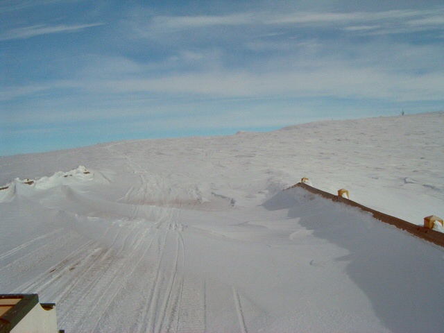
Trans Labrador Highway 1 06-MAR-2004 (Click to enlarge) Highway blocked by snow that drifted into a rock cut. |
|
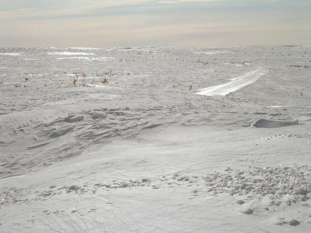
Trans Labrador Highway 2 06-MAR-2004 (Click to enlarge) Highway disappears underneath the snow. |
|
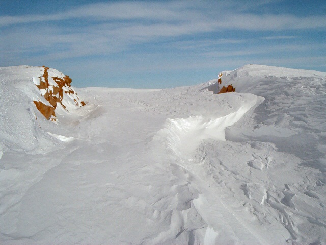
Trans Labrador Highway 3 06-MAR-2004 (Click to enlarge) Part of the highway is visible here. Also depicts the barren nature of the land which makes it so susceptible to blowing and drifting snow. |
|
To see more of the Stormpost Photo Collection, just make a selection from the list on the right. |
|
QUEBEC LOWER NORTH SHORE
St. Augustine River
St. Paul's River
Brador
Lourdes-de-B.-Sablon
Blanc-Sablon
LABRADOR STRAITS
L'Anse au Clair
Forteau
Point Amour
L'Anse au Loup
West St. Modeste
Capstan Island
Pinware
Pinware River
Red Bay
SOUTHEAST LABRADOR COAST
Lodge Bay
Mary's Harbour
Port Hope Simpson
Charlottetown
GUEST PHOTOS
R. Smith (2007-08)
La Tabatiere (2008)
May Storm (May 2007)
TLH (Apr 2004)
Lourdes (Feb 2004)
SE Lab (Mar 2004)
TLH (Mar 2004)
Charlottetown
Crow Head
Crow Head & Rock Cut
Blanc-Sablon
Mary's Harbour snow
2004 Blizzard
Snowslide (Capstan I.)
Labrador Flag
TLH (May 2001)
TLH (Mar 2001)
1995 Blizzards